




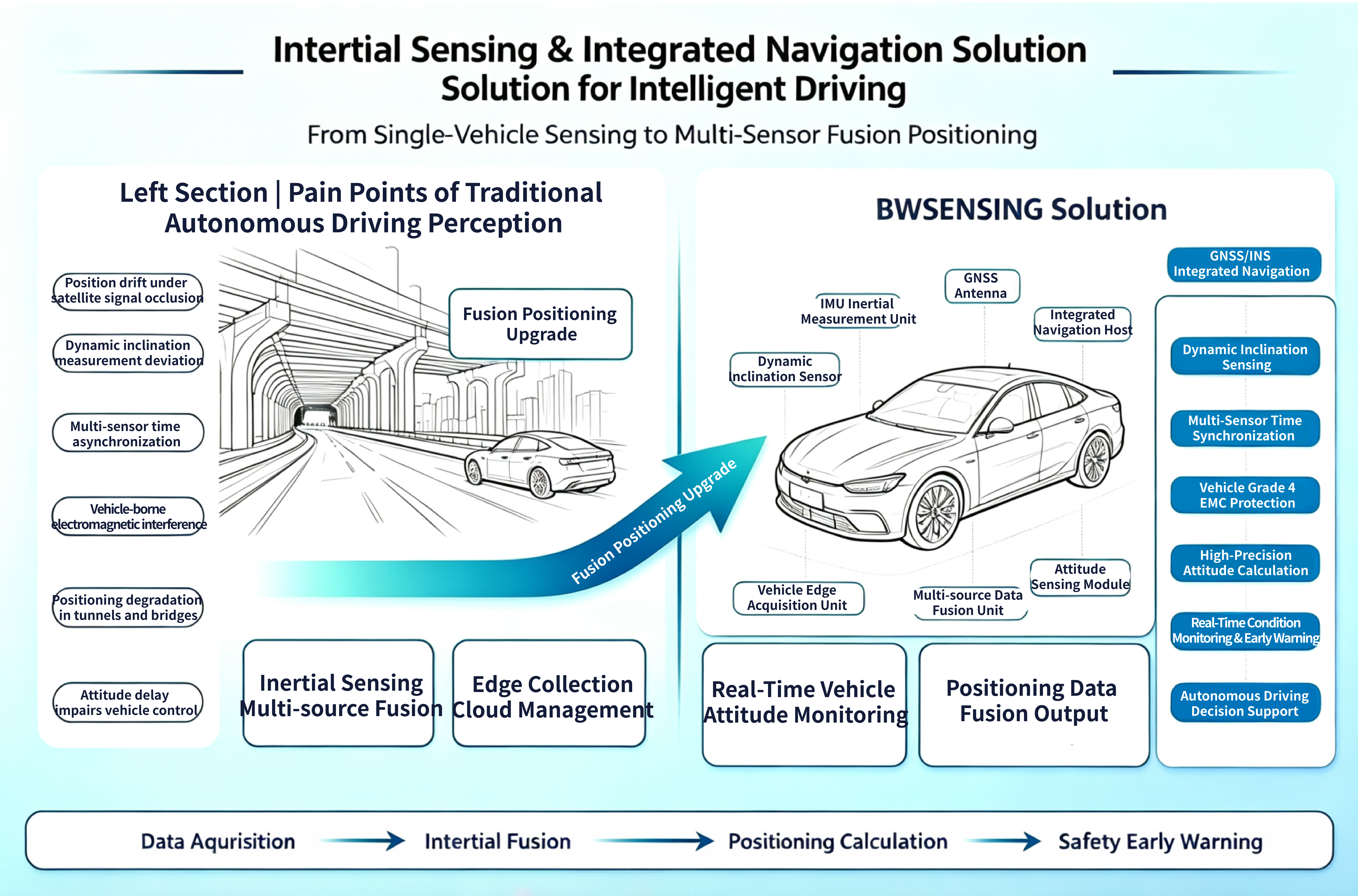
For autonomous driving scenarios, we offer an integrated perception solution featuring self-developed MEMS inertial units, dynamic inclination sensors, and GNSS/INS integrated navigation. Leveraging i
Shared:


Inertial Inclination & Integrated Navigation Perception Solution for Autonomous Driving
Independently developed MEMS inertial units, dynamic inclination sensors and GNSS/INS integrated navigation devices for autonomous vehicles. Effectively solve positioning and attitude drift issues under satellite signal occlusion such as tunnels, viaducts and underground parking lots.
Common Industry Pain Points
Satellite signals are easily blocked in tunnels, underground parking lots and dense urban areas; pure GNSS equipment cannot maintain continuous stable positioning.
Dynamic error of ordinary inclination sensors increases on bumpy roads and continuous curves, affecting chassis control logic.
Inconsistent time reference among cameras, radars and satellite receivers limits multi-sensor fusion accuracy.
Electromagnetic interference generated by on-board motors and wiring harness causes jitter and distortion of sensing data.
Equipped with self-developed inertial fusion algorithm and Class 4 on-board EMC filtering algorithm to adapt to complex vehicle electrical environment.
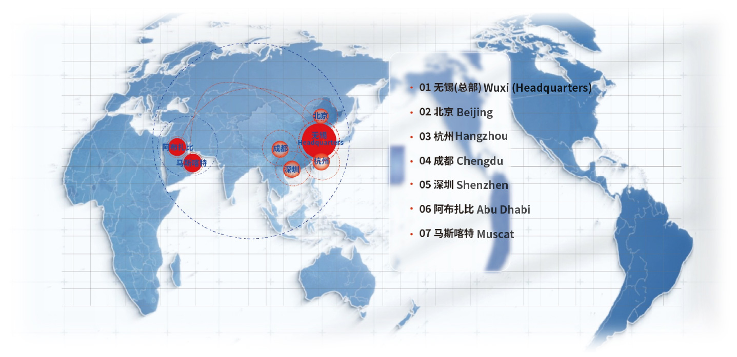
BWSENSING Global Footprint
Navigation Technology Route Comparison
Inertial technology is one of the core technologies for automatic control and autonomous navigation of any moving carrier. Its core components consist of gyroscopes and accelerometers. It relies entirely on the carrier’s own equipment for independent navigation, operating in air, ground/underground, surface/underwater environments. Inertial technology supports functions ranging from simple static inclination measurement to dynamic attitude measurement, trajectory tracking and navigation positioning. It has been widely applied in national defense, aerospace and marine equipment. Applications in intelligent driving, IoT and industrial automation are rapidly expanding. Comparison of inertial navigation, satellite navigation and INS/GNSS integrated navigation:
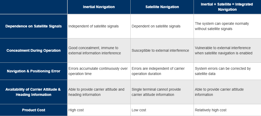
Horizontal comparison of core features of three navigation technologies
Four Core
Technical Advantages
Advantage 1: Self-developed MEMS Architecture & Synchronous Calibration Process
Self-developed 6-axis MEMS sensing architecture
Multi-sensor time-space synchronous calibration
Multi-node dynamic inclination solving logic
Inertial fusion compensation algorithm under GNSS signal loss
Adaptable to satellite-free scenarios such as tunnels and underground parking lots.
Advantage 2: Inertial Attitude Fusion Algorithm
Combined Kalman filtering for accelerometer and gyroscope
Attitude matrix solving for vehicle sideslip and angle of attack
Output smooth and stable attitude data during dynamic driving.
Advantage 3: High-precision Error Compensation Model
Real-time sideslip error compensation via deep learning
Rotation matrix correction for installation deviation
Long-term temperature drift ≤0.05°/10h.
Advantage 4: Full-range Factory Calibration Process
Full-temperature calibration for 3-axis accelerometers
Turntable calibration for multi-range gyroscopes
All error compensations completed before delivery, ready for vehicle installation.
Autonomous Driving Hardware Product Portfolio
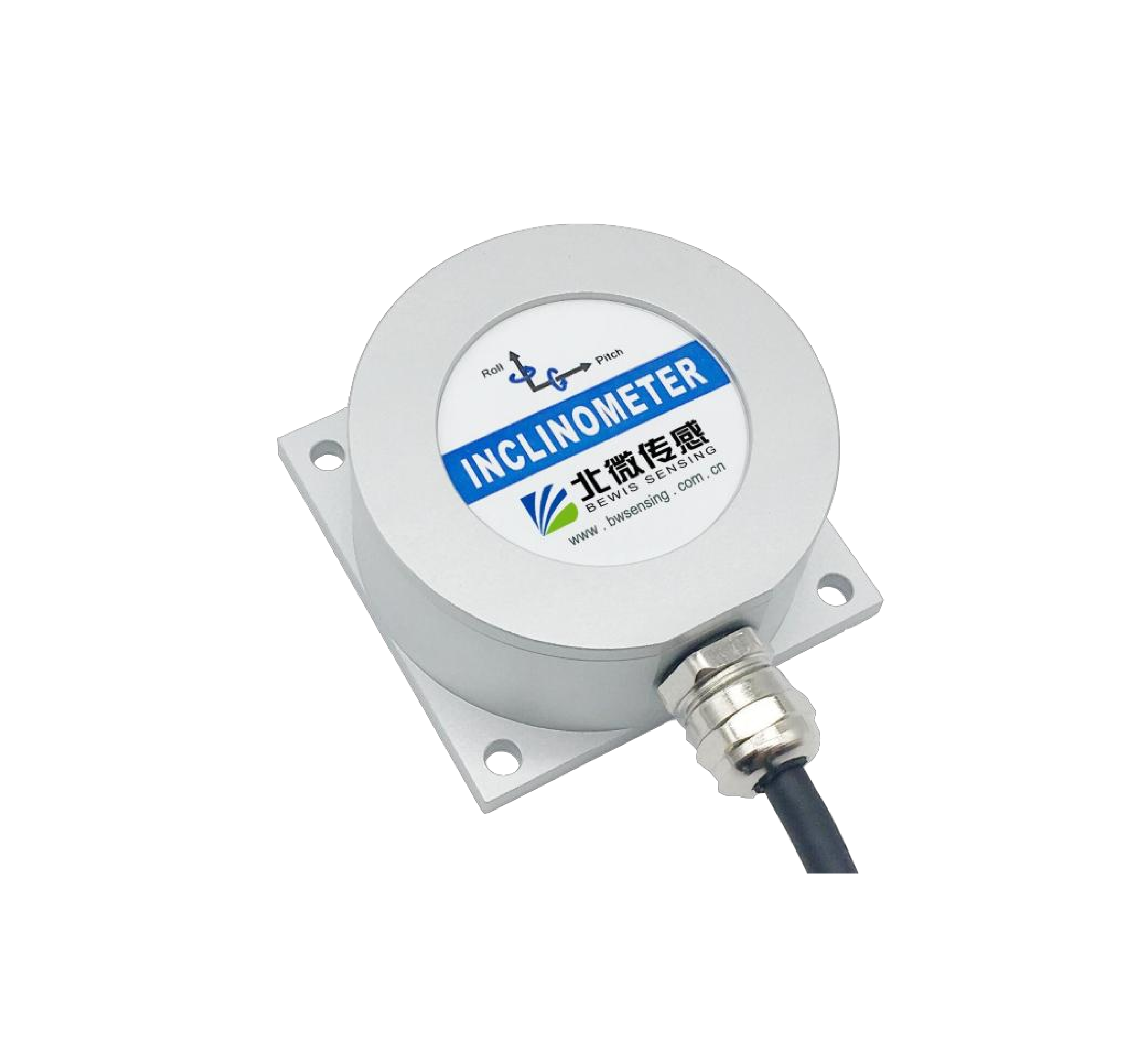
BW-VG225|Low-cost CAN Bus Dynamic Inclination Sensor
BW-VG225
Application: Construction machinery, agricultural machinery, autonomous driving chassis attitude acquisition
Static Accuracy 0.01° / Dynamic Accuracy 0.5°
Standard CAN bus output, industrial housing
Multi-dimensional error compensation, shock-resistant structure, MTBF ≥90,000 hours, suitable for harsh vehicle operating conditions.
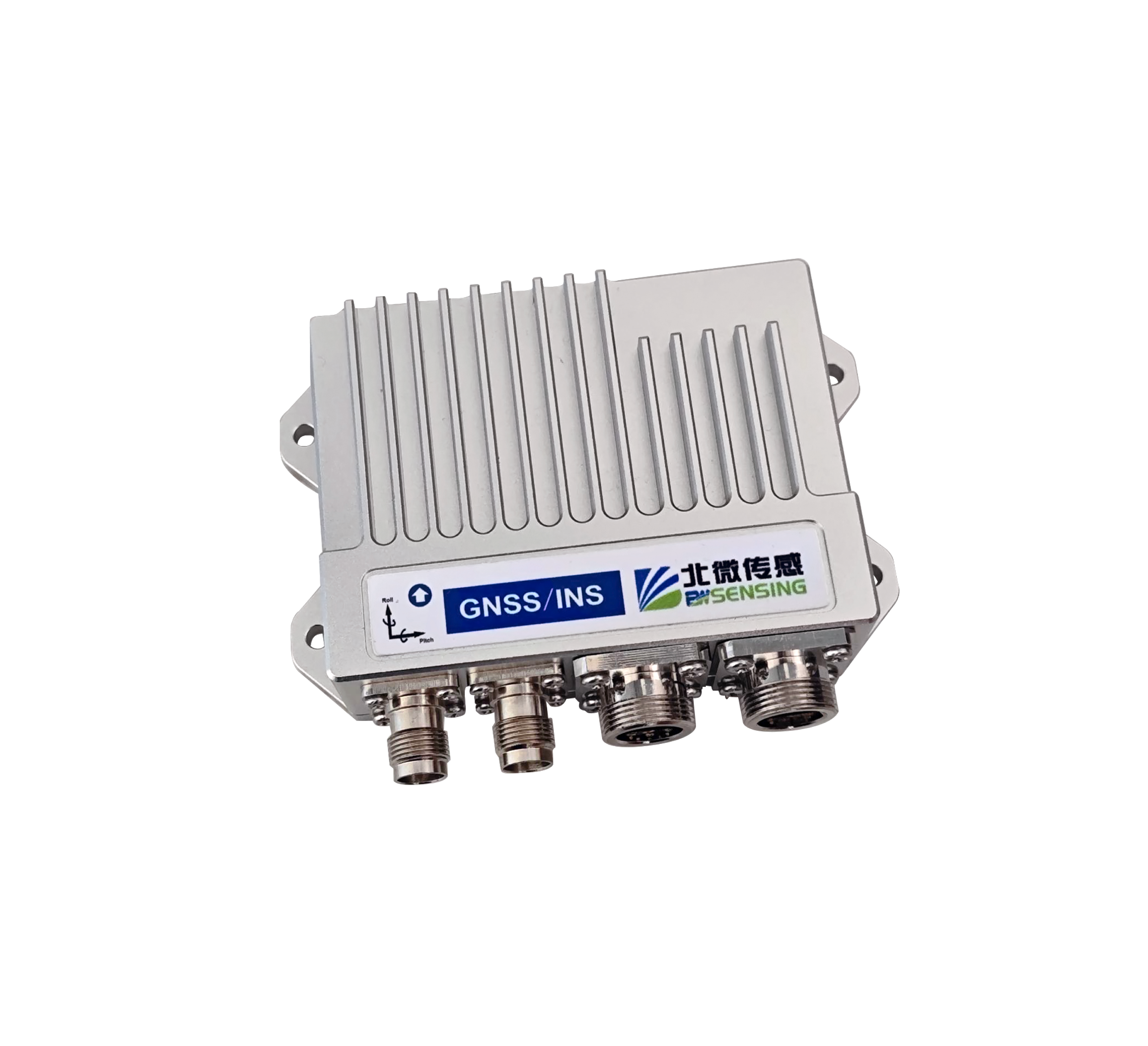
GI320|Cost-effective Automotive-grade Integrated Navigation
GI320
Application: Commercial vehicles, passenger car ADAS, low-speed unmanned vehicles in parks, autonomous navigation
RTK Positioning Accuracy 0.8cm+1ppm (Horizontal), 1.5cm+1ppm (Vertical)
Drift <0.2% per kilometer under GNSS signal loss
Supports network RTK/PPP, CAN-FD and odometer fusion, designed for L2 passenger vehicle integration.
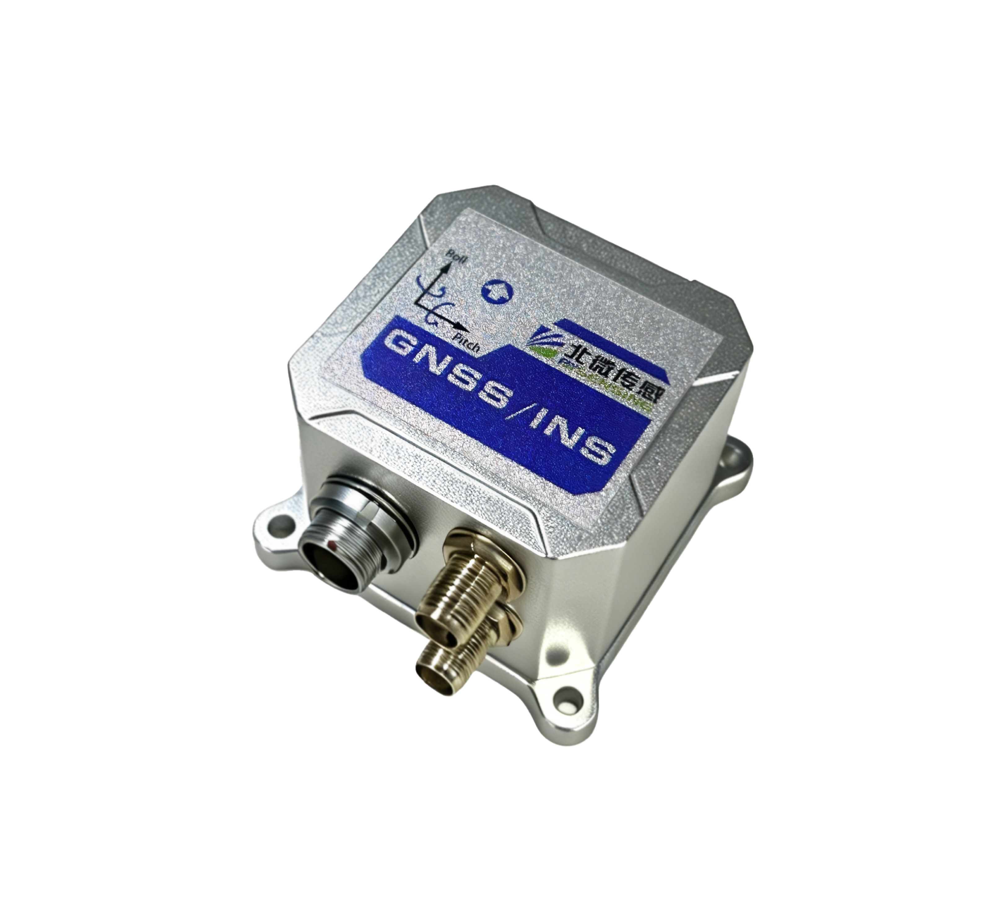
BW-GI420|11-axis Wide-range Integrated Navigation
BW-GI420
Application: Commercial vehicles, low-speed unmanned vehicles
IP67 protection, operating temperature -40℃~+85℃
Raw inertial/GNSS data output, customizable dynamic model
11-axis sensing architecture, high vibration resistance, adaptable to dusty and bumpy environments.
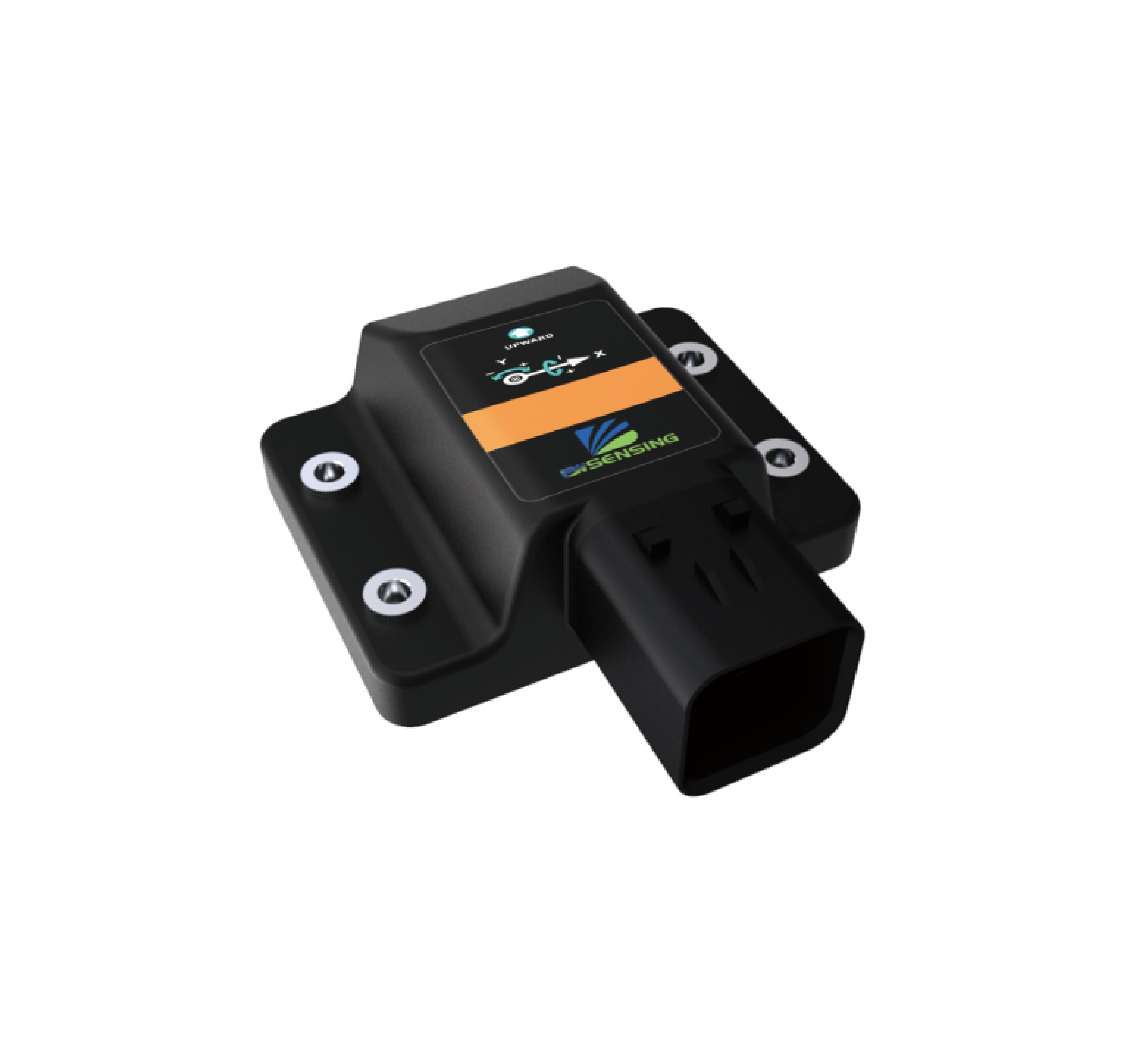
BW-VG55R|Multi-redundant Dynamic Inclination Sensor
BW-VG55R
Application: High-reliability special engineering machinery, unmanned equipment
Static Accuracy 0.1°(RMS) / Dynamic Accuracy 1°(RMS)
3-channel hardware redundancy, built-in fault self-check
Multi-backup sensing architecture to meet safety requirements for uninterrupted operation.
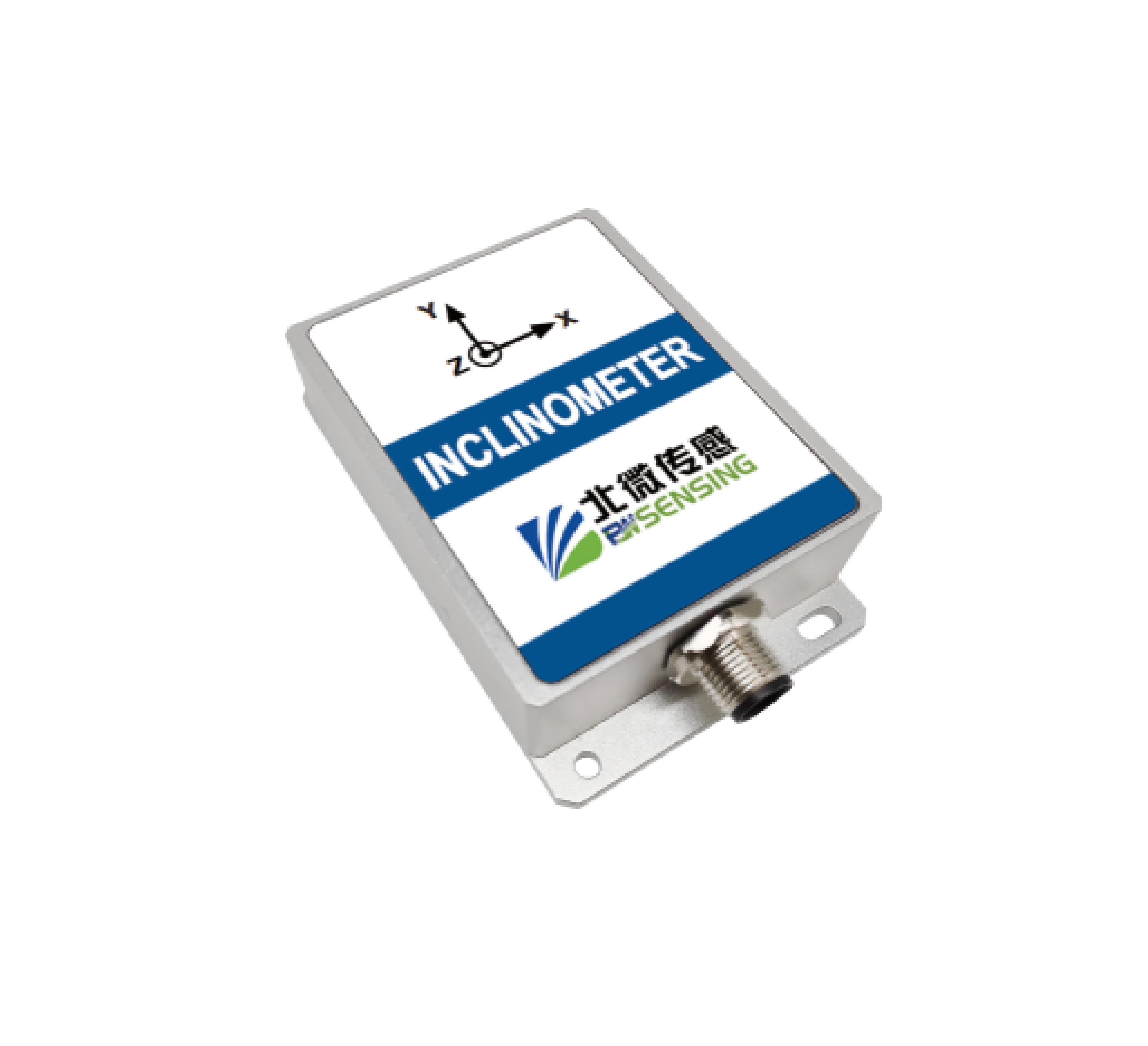
BW-VG225E|Class 4 EMC Automotive-grade Dynamic Inclination Sensor
BW-VG225E
Application: Unmanned vehicles, special vehicles, platform stabilization, UAVs, intelligent excavators
Static Accuracy 0.01° / Dynamic Accuracy 1°
Complies with IEC61000 Class 4 automotive EMC standard
Dual static/dynamic measurement mode, compact size for limited on-board installation space.
Standard Factory Calibration Items
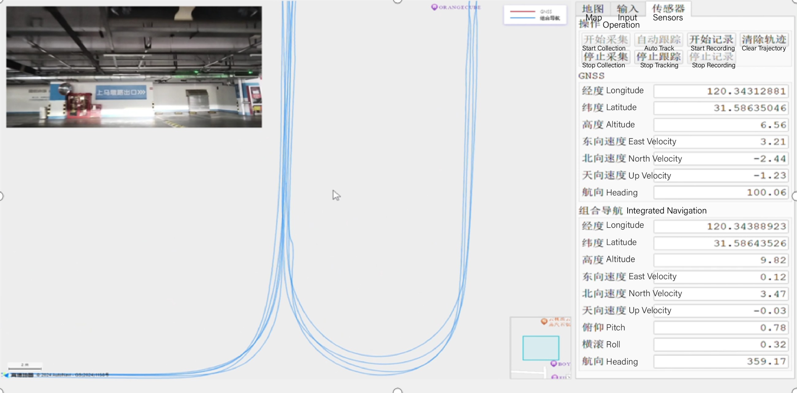
On-board calibration lab with multi-axis turntable
Three sets of standardized calibration are performed before delivery; all parameters are official nominal performance:
Open-sky RTK scenario: Horizontal CEP95 ≤0.2m, static heading error ≤0.15°
Partial occlusion on viaduct: Drift controlled within 0.2% per kilometer under partial GNSS loss
Full occlusion inside tunnel: No obvious distortion of inclination output
Field Application Cases
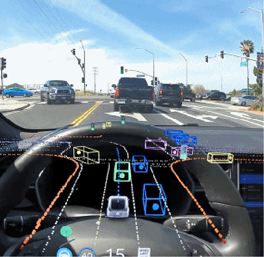
IMU+GNSS integrated navigation for L2+ passenger vehicles
L2+ Passenger Vehicle Integrated Navigation Case
Project Overview: Partnered with autonomous driving division of leading domestic automaker for L2+ passenger vehicle scenarios. Equipment works under rain, snow, fog and smoke. Supports automatic compensation for installation offset, load and tire pressure deviation. Compatible with network RTK and PPP-RTK, supports differential SDK integration.
Solution Configuration: Integrated navigation transmits GGA positioning data, receives differential data from Tbox, fuses vehicle CAN signals for positioning solving. Output raw IMU data, raw GNSS data and fusion positioning results to domain controller. Coordinate conversion implemented to match vehicle coordinate system.
Customer Value: Open areas on urban streets/highways: Horizontal positioning CEP95 ≤0.1m; driving beside viaducts/tree shading: Horizontal positioning CEP95 ≤0.25m; long continuous occlusion: CEP95 ≤2.5m for 4.5km driving.
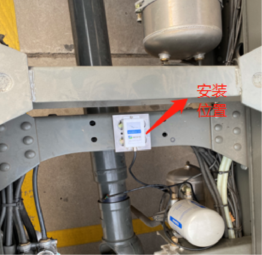
VG225 applied to commercial vehicle TCU chassis attitude sensing
Commercial Vehicle Chassis Attitude Control Case
Project Overview: Supports automatic transmission TCU control system of commercial vehicles to realize intelligent gear shift control. TCU recognizes driver intention via attitude signals and optimizes shift logic. Products supplied to BAIC and Bosch commercial vehicle projects, continuously delivering stable angle data.
Solution Configuration: BW-VG225 6-axis MEMS dynamic inclination sensor. Dynamic roll/pitch angle accuracy up to 0.5°. Full attitude operation, surface mounting to reduce mechanical wear.
Customer Value: Smoother gear shifting and improved driving safety; reduced fuel consumption, meeting domestic and European emission standards.
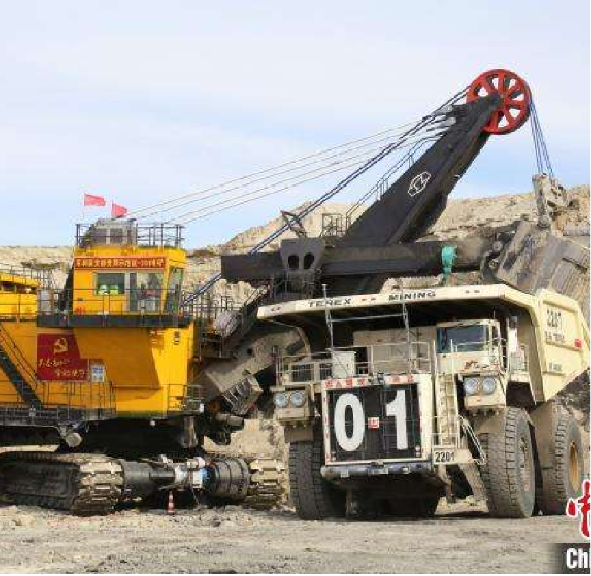
GI410 supports L4 autonomous mining truck operation
L4 Autonomous Mining Truck Project
Project Overview: Mines and ports are typical landing scenarios for L4 autonomous commercial vehicles with relatively simple road conditions. Cooperated with Weichai, Tongli Heavy Industry and other manufacturers for open-pit unmanned transport. Integrated navigation outputs real-time vehicle attitude and position data to support autonomous driving decisions.
Solution Configuration: GI410 GNSS+IMU integrated navigation system. Dynamic roll/pitch angle accuracy up to 0.1°. Standard positioning 1m; up to 5cm under RTK mode. Full attitude operation, surface mounting reduces mechanical wear.
Customer Value: Continuous stable attitude and position sensing data; guarantees autonomous operation and improves safety of unmanned mining vehicles.
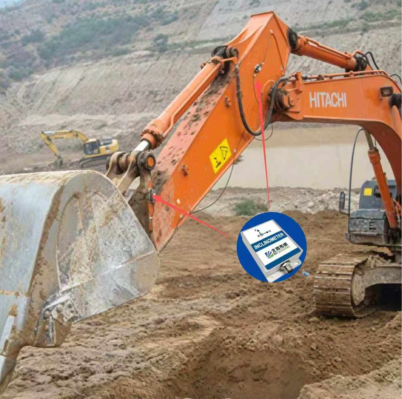
VG225E applied to intelligent excavator guidance system
Intelligent Excavator Project
Project Overview: Excavator intelligent guidance system solves operation challenges under water or blind vision. Enables closed-loop bucket control with built-in slope leveling functions, lowering operation threshold. No on-site surveyor required and reduces reliance on operator experience.
Solution Configuration: VG225E 6-axis MEMS micro-inertial system. Dynamic roll/pitch angle accuracy up to 0.1°. Full attitude operation, surface mounting effectively reduces mechanical wear.
Customer Value: Excavation precision independent of operator skill; operation efficiency improved by over 30%. Avoid over-excavation and under-excavation under any vehicle attitude; slope flatness error controlled within 0.5°. Boost construction efficiency, reduce on-site safety risks and cut labor costs.
Self-developed Inertial Fusion Algorithm System
Static-dynamic inclination fusion algorithm eliminates data distortion on bumpy roads
Class 4 digital EMC filter suppresses electromagnetic noise from motors and wiring harness
Full-temperature calibration reduces zero drift caused by temperature variation
Request Samples, Download Datasheets, Get Customized Industry Solutions
Contact Us-
STAY CONNECTED




-
8:00am-7:00 pm Service Online
WhatsApp/Tel:+86 15050 672 146
+86 17606 118 008
Commercial:sales@bwsensing.com
Customer Service:support@bwsensing.com

Copyright © 2010-2026 Wuxi BEWIS Sensing Technology LLC 苏ICP备14001101号-6 Privacy Policy Cookies

 +86 189 2129 2620
+86 176 0611 8008 sales@bwsensing.com